
CODE-DE Catalog Client
Now that the CODE-DE (opens new window) (Copernicus Data and Exploitation Platform - Deutschland) has officially (opens new window) launched (opens new window), we're proud to present our contribution to it: the Catalog Web Client.
This component available via the marketplace of the CODE-DE and allows to visually interact with and perform searches on the catalog of Earth Observation image archive. Though it was designed with CODE-DE in mind, its use of open standards and interfaces means that it is easily used with other catalog and viewing systems (such as our own free and open source products: SxCAT and ngEO-Browse-Server (opens new window) or EOxServer (opens new window)).
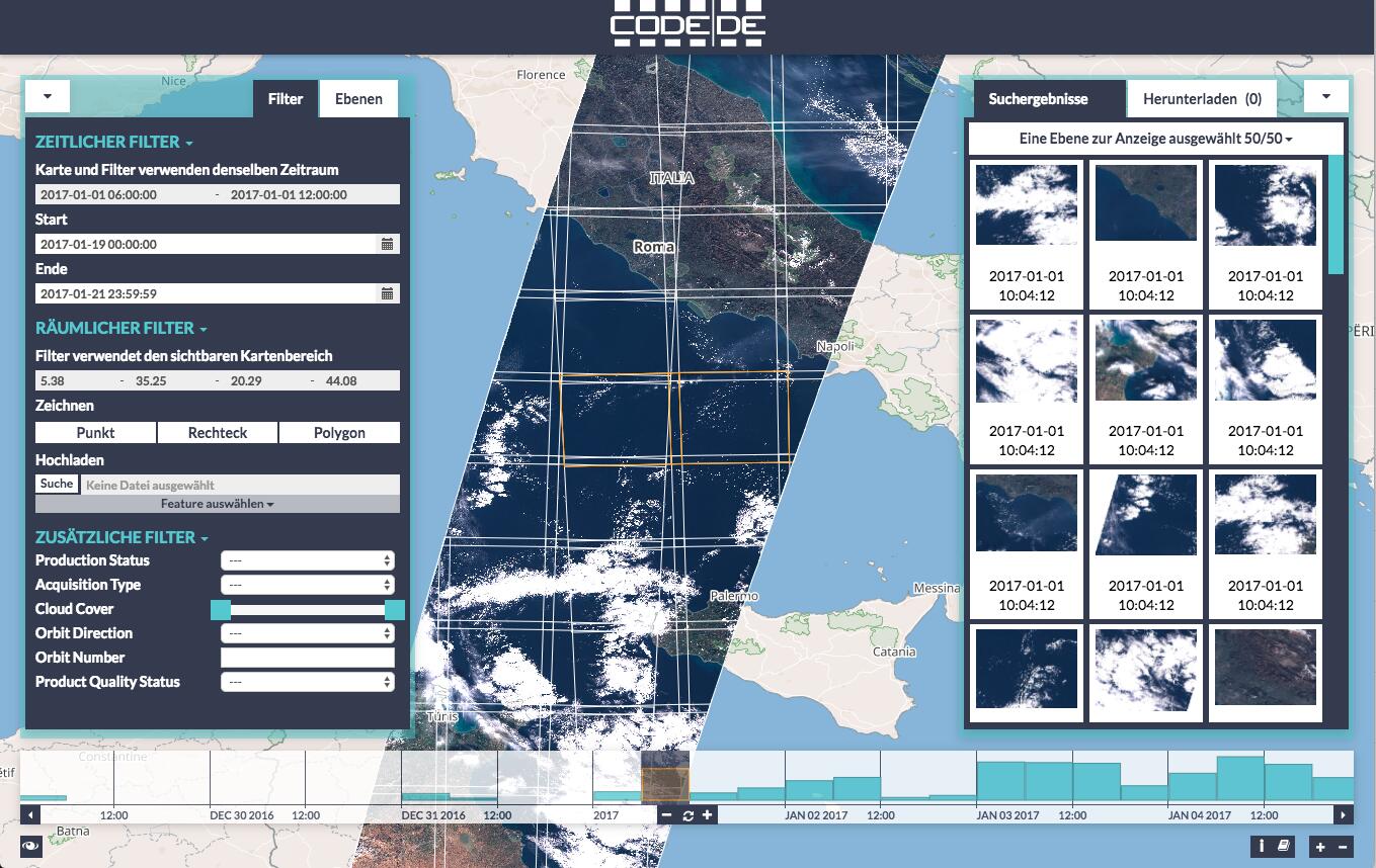
The client can be used to quickly filter satellite scenes that you are actually interested in by setting various filters: time, spatial and additional.
# Time Filter
The time is either configured using the date input widget or by drawing on the time-slider. Drawing is an intuitive way to select a time span of interest as the relative number of records can be seen as a histogram. The selected area can be manipulated (resized and moved), to further narrow down the temporal selection. Also, a click on a histogram bucket automatically selects the timespan of that bucket. The buckets always refer to the amount of images in that timespan, and not only to the searched ones.

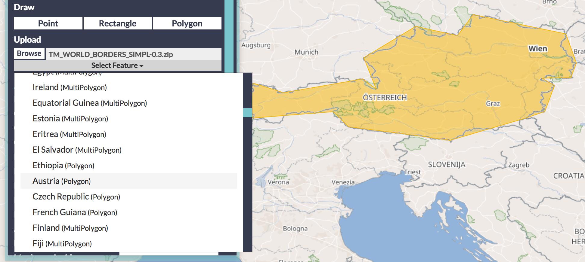
# Spatial Filter
There are several ways to set a spatial filter: either by drawing a point, rectangle, or polygon, or by loading a shapefile into the client and selecting a feature as an area of interest (For example a shapefile containing country borders (opens new window)). When no explicit spatial filter is set, then the current map view extent is used as a filter.
# Additional Filters
This widget allows to specify "expert" filters, to further narrow down the search. The list of available additional filters depends on the capabilities of the catalog, but typically includes filters such as the cloud coverage of the image (for optical sensors) or the antenna polarisation channels (for radar based images).
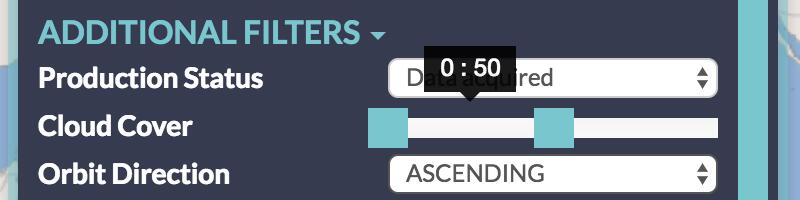
Due to the nature of the backend protocols involved, those filters are not reflected by the shown images on the map, so a warning is shown when one of these filters is set.
Both the map and the time-slider widgets provide three distinct functionalities: to give a spatial and temporal context, allow to directly edit the spatial/temporal filter, and to show search results.
On the map, both the browse images and footprints of the query results are displayed. The footprints are interactive, a click shows a context menu, where the images can be further inspected or added to the download list.
The time-slider works similarly: just like the map, it can be zoomed and panned and also shows where on the temporal axes images can be found. When zoomed out, the distribution of the available images is shown as a histogram like plot. But zoomed in, the individual images are shown as small dots or boxes.
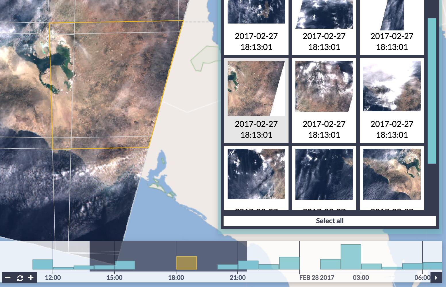
# Search Results and Details
Whenever a filter changes, a query is performed. The search results are displayed in the right panel as a thumbnails and times the images were taken. The result list, is interactive as-well: clicked images are added to the download list, and additional information for each image can also be viewed.
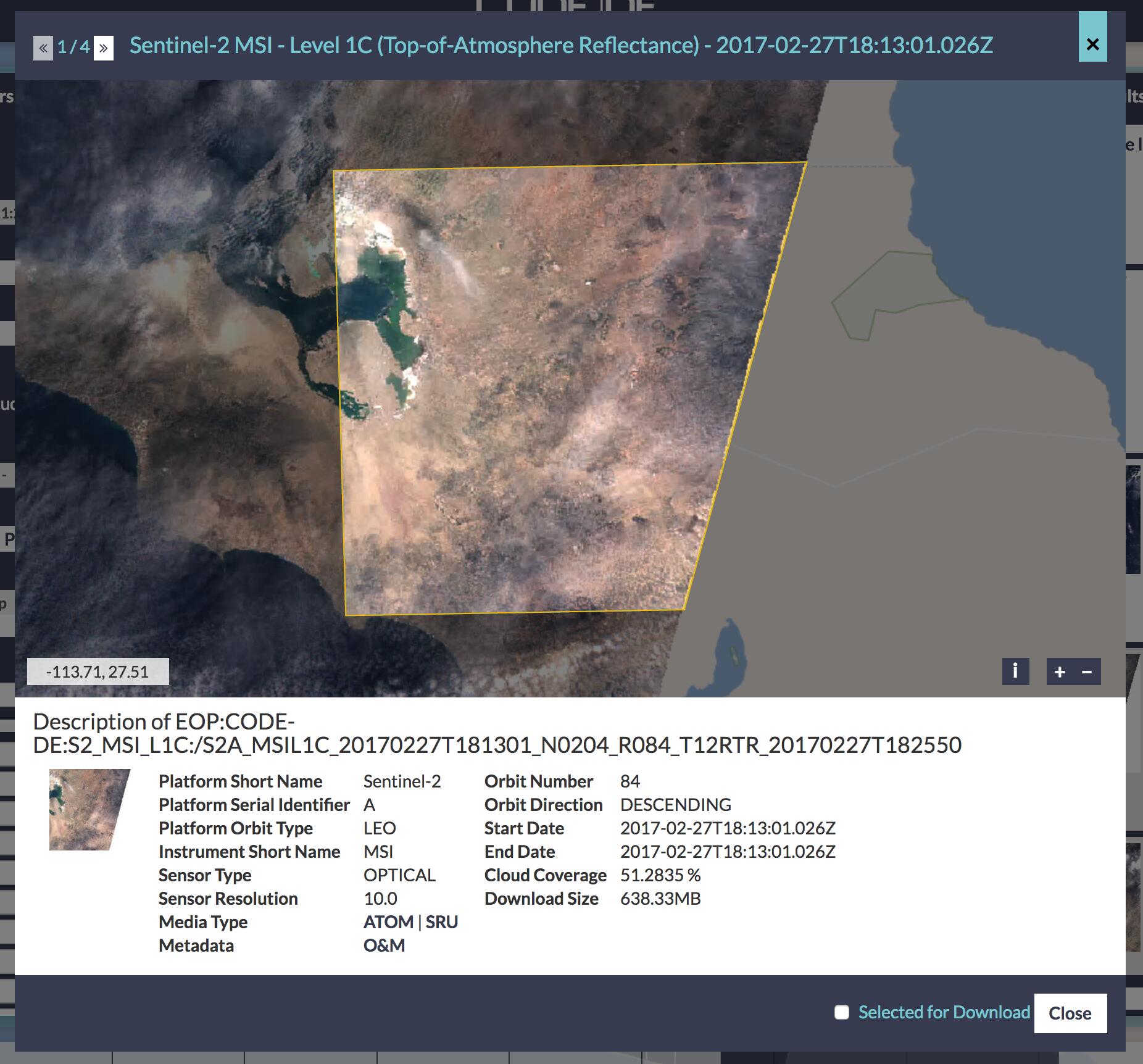
The record details view shows the image itself on an interactive map and further metadata associated with the selected image.
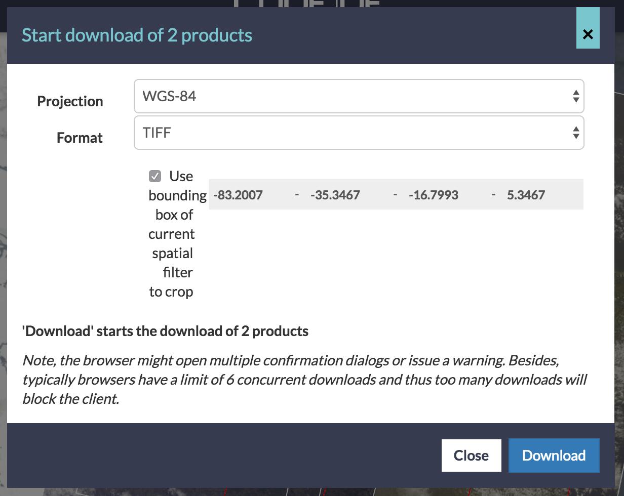
# Download
The right panel also houses the Download list: all images that were selected (either directly from the map, from the result list, or the image details) can again be found here. In this list, the images can be inspected once again, and removed if not required. Now, several download options are provided: either directly using the browsers download manager itself or as a metalink file or list of URLs to the selected files. This allows to pass the selected datasets on to an external download manager for a bulk downloading.
When a WCS server is configured as a download backend, then additional download options are possible: such as cropping the image or using a specific file format or projection. This assures that the amount of transferred data is reduced to a minimum and that the specialized operations (such as reprojection) are done on the server.
# Backends
In the client configuration, each layer is split into three distinct properties: the display, the searching, and the download. For the display part, the layer can be configured to use either WMS or WMTS, two of the most popular viewing protocols for map data.
For the search part, either EO-WCS (the extension of WCS for Earth Observation) or OpenSearch is supported. This allows to plug in a wide variety of commercial or free servers and makes the Web Client a very versatile front end for many different systems.
The download can either be purely HTTP based or make use of WCS in order to allow the aforementioned benefits.
Please feel free to try out our latest, cool application (opens new window) and let us know what you think!