EOxCloudless for Common Agricultural Policy (CAP)
Remote sensing goes hand in hand with extensive land monitoring, needless to say agriculture is such a case. Data analysis aiming at monitoring land and crops need high and consistent temporal resolution data supply.
CAP (opens new window) is an economical ecosystem to sustain and support agriculture throughout Europe. This helps to achieve better competitive conditions within and outside of agricultural industry and control the impact of agriculture on the environment.
Beginning in 2020 crop monitoring with the help of remote sensing should be established in Europe as a part of modernization of the CAP ecosystem. This whole endeavor should be tailored to each Paying Agency in the member states individually. Providing specific and accurate information about state of crops, grassland, forests, etc. such remote sensing policy can provide unprecedented amount of information across whole countries in a manner of hours not days or weeks.
At EOX we are cooperating with several Paying Agencies (opens new window) to introduce methods and products which will help to monitor large areas frequently and with the most precise information.
# Satellite Imagery
The core data infrastructure should be based on remote sensing, i.e. Sentinel-1 and Sentinel-2 satellite constellations of the European Commission (EC). For the primary data dissemination and delivery the Copernicus Data and Information Access Services (opens new window) (DIAS) exploitation is foreseen.
EOX is in the DIAS MUNDI (opens new window) and we are trying to improve MUNDI's offer and services by evaluating, processing and developing land monitoring methods and relevant data products (see https://cloudless.eox.at/ (opens new window)). The data we offer ranges from RGB Natural Colors Satellite Imagery, over Vegetation Indexes (NDVI, CVI, EVI) to SAR Coherence or Backscatter maps.
For technical details see the EOxCloudless ARD Article. The description there introduces the processing methods we are using to create various data to be used for visual, machine learning (ML), land-use and land-cover analysis and more.
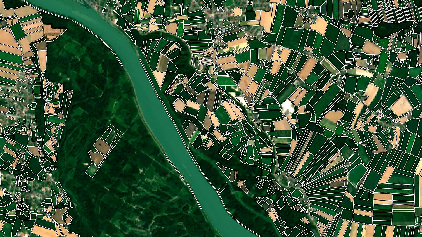
With these data sources vegetation can be monitored over the whole vegetation period continuously, up to weekly with Sentinel-1 data and monthly with Sentinel-2. (For Sentinel-2 seasonality and the weather/cloud coverage can impact the acquisitions, from measurement every week to almost two months difference.) The gif below shows the NDVI change from March to October 2018, the greener the higher NDVI, brown and white means no vegetation.
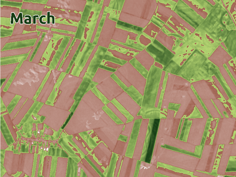
NDVI change around Franzensdorf, Austria 2018
Next image shows the vegetation maximum in the area around Sporring, Denmark (north of Aarhus, DEN) represented by RGB composite of average Backscatter values from 4th of June to 17th of June 2018.
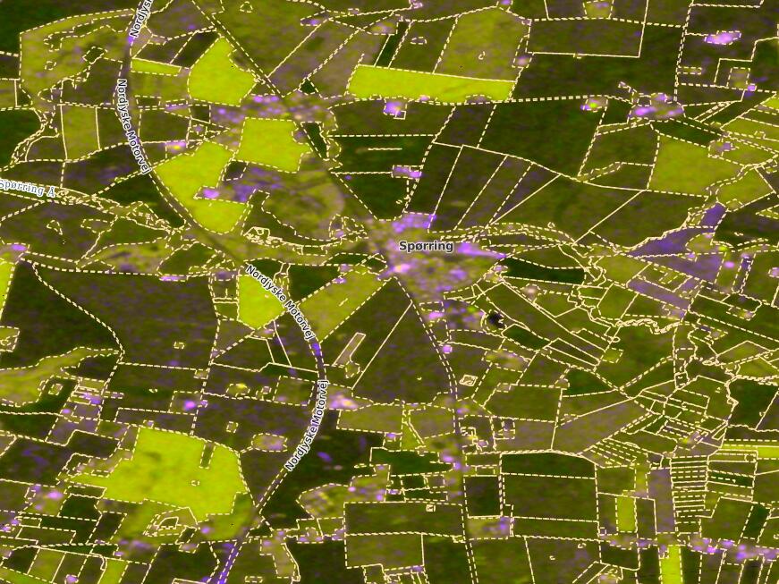
North of Aarhus, Denmark - Vegetation Maximum 04.06.-17.06.2018 RGB Gamma0 Average [dB] Composite
With the means and tools at hand we can offer services all over the globe for anyone, from a single field to the whole World.
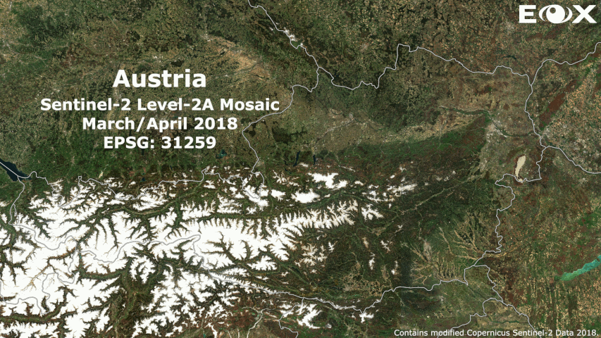
Austria bi-monthly 2018 L3 Mosaics - Sentinel-2 Surface Reflectance
# CAP monitoring
Combining the satellite data with ground truth datasets, confident monitoring structure can be established. Relying on ML and Classification such infrastructure can provide continuous stream of information able to differentiate even the slightest change over an area. Without the need of shoveling through all the data every single time.
The DIAS facilities are the key for such campaigns, with the Sentinel data stored in the same cloud environment, and the possibility to use additional services available there, it has never been easier to access so much information at the same time. Additionally custom data can be uploaded to the cloud at any time, e.g. training or already trained datasets with labels for ML, weather forecasts, measurements and models, climate models, hydrological features, soil profiles, can individually shape the way to the final result.
The decisions from the results can determine the distribution of the CAP resources for Paying Agencies. Each Paying Agency can decide how to implement the monitoring approach based on the tools and policy in their area.
# More Information
For additional information visit: https://cloudless.eox.at/ (opens new window) and contact us if you have questions.
Visit us in Copenhagen, Denmark at the 55th Panta Rhei Conference from 22th to 24th of May 2019.
Petr Ševčík, EOX IT Services GmbH Email: petr.sevcik@eox.at
Contains Modified Copernicus Sentinel-1 and Sentinel-2 Data 2018.