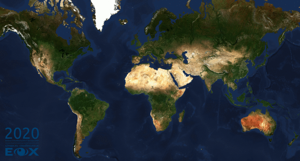
Sentinel-2 cloudless 2020
Another year went by and our most recent update of the EOxCloudless (opens new window) satellite map Sentinel-2 cloudless (opens new window) has been released!
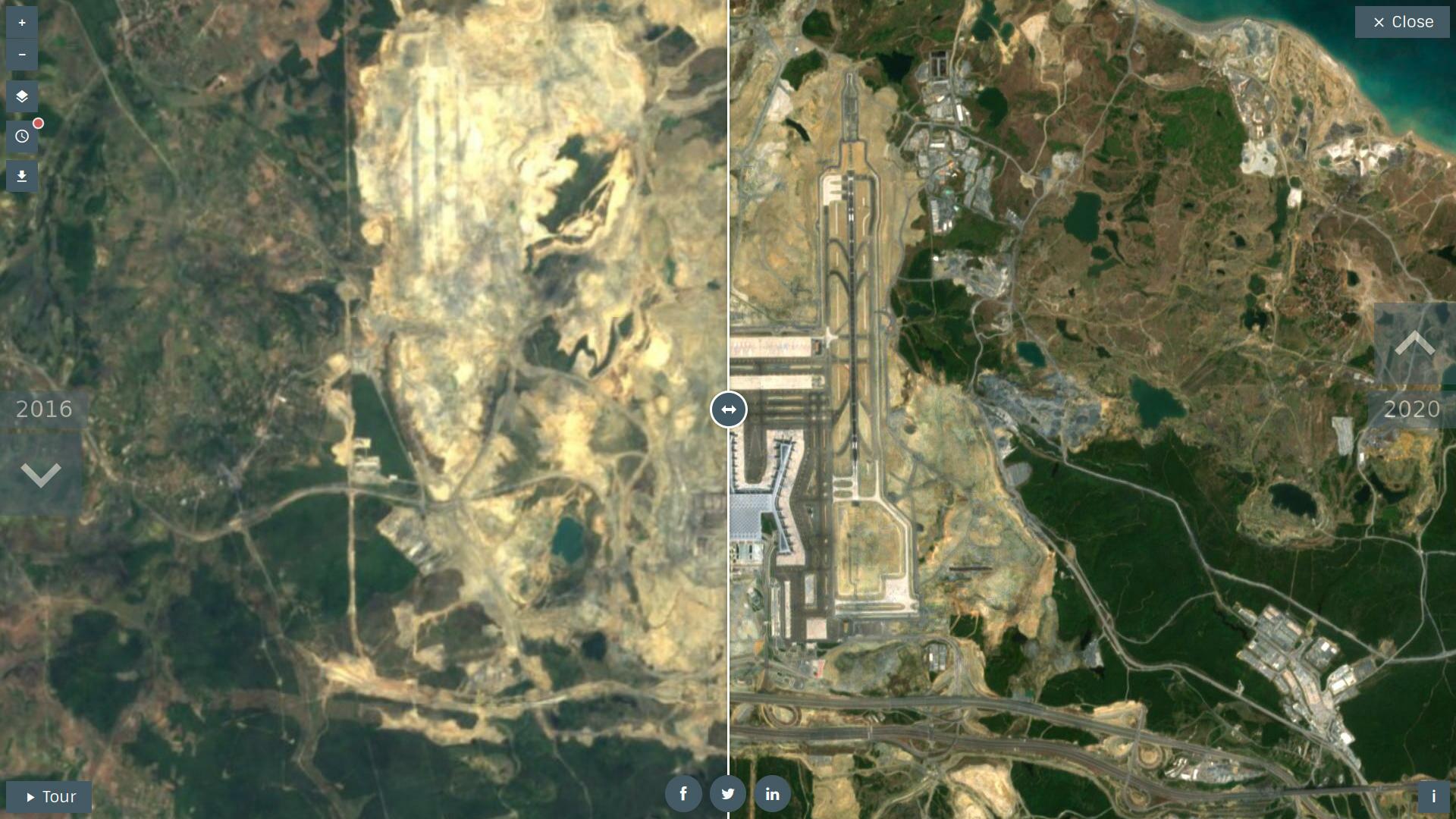
# Layer comparison from 2016 to 2020
Apart from major technical improvements of the data foundation the website Sentinel-2 cloudless (opens new window) has got a new coat as well. You can now browse all years of our global satellite layers by clicking the clock symbol top left.
Can help us to find more interesting areas that changed over the past years in our Sentinel-2 cloudless (opens new window)? Feel free to share with us any beautiful examples on Twitter (opens new window).
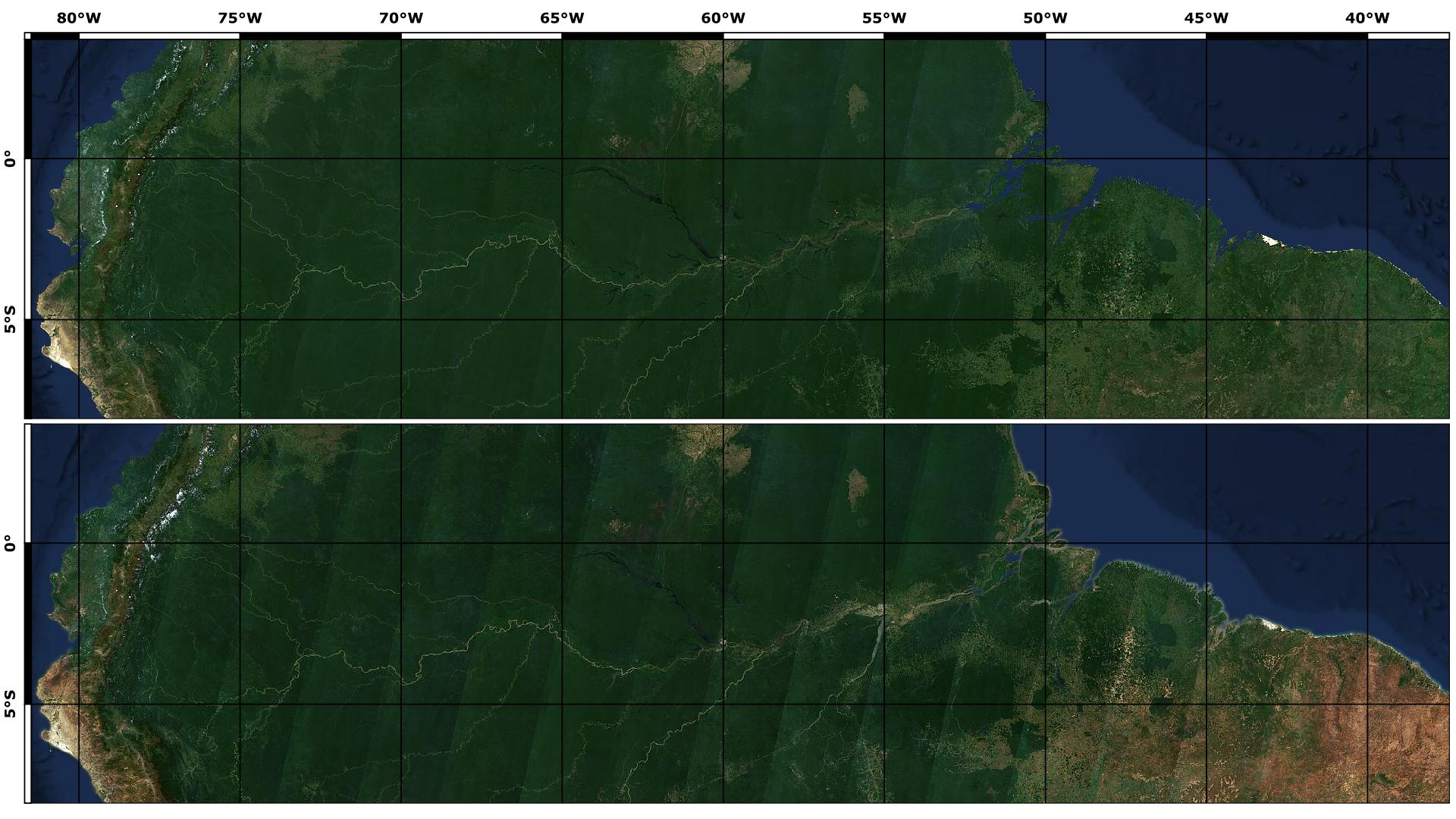
# Less striping effects in the map
The biggest change is the implementation of a Bidirectional Reflectance Distribution Function (BRDF) to correct the differences in brightness across the Sentinel-2 acquisitions in west-east direction. This improves the overall smoothness of our yearly map. The most challenging regions are around the equator, where the whole year of data has been used as input data. Let’s revisit the same region like the blog from last year (opens new window) to see the improvements.
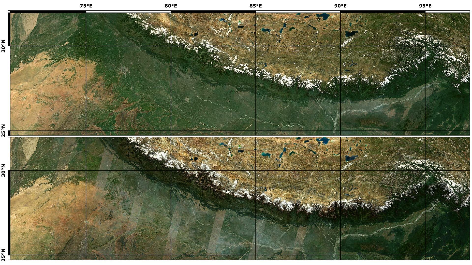
# Even smoother transitions between climate zones
The BRDF correction alone is not enough to compensate for the differences between the seasons, therefore we tried to define time intervals that are not too large to keep the mosaic as homogeneous as possible.
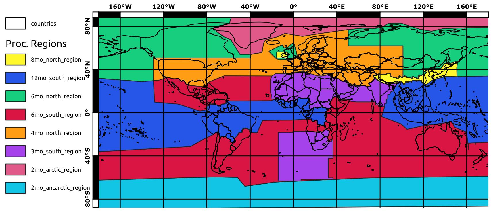
As you can see in the image above the borders of the climate zones over land are following state or province borders of various countries. Given that most of the borders between countries follow distinct geomorphological features thus making it easier to split the regions naturally. We went even further and made these borders fuzzy to make these transitions even less apparent. In the example below the climate zones border at the Himalayas has clearly improved since the 2019 mosaic.
# Following next...
Apart from the next satellite map for the year 2021 which will be out around this time next year, the biggest news regarding the EOX map products (opens new window) is, that we are currently working on an update for our custom OpenStreetMap (opens new window) rendering, labels, and more.
Finally, if you are looking for a nice screensaver to watch while on a coffee break click the "Tour" button at the bottom left of https://s2maps.eu/ (opens new window) and enjoy the ride. Also please note that our maps are free to use non commercially with proper attribution, if you aim to use our maps in your business please head to https://cloudless.eox.at/ (opens new window) or contact us directly via cloudless@eox.at.
# License
The 2016 version is provided for free under the Creative Commons Attribution 4.0 International Public License (opens new window) (CC BY 4.0), the 2018 - 2020 under Creative Commons Attribution-NonCommercial-ShareAlike 4.0 International Public License (opens new window) (CC BY-NS-SA 4.0). The required attribution is "Sentinel-2 cloudless - (opens new window) https://s2maps.eu/ (opens new window) by EOX IT Services GmbH (opens new window) (Contains modified Copernicus Sentinel data 2016 & 2017)" for 2016, "Sentinel-2 cloudless - (opens new window) https://s2maps.eu (opens new window) by EOX IT Services GmbH (opens new window) (Contains modified Copernicus Sentinel data 2017 & 2018)" for 2018, and "Sentinel-2 cloudless - (opens new window) https://s2maps.eu (opens new window) by EOX IT Services GmbH (opens new window) (Contains modified Copernicus Sentinel data 2019)" for 2019 and "Sentinel-2 cloudless - (opens new window) https://s2maps.eu (opens new window) by EOX IT Services GmbH (opens new window) (Contains modified Copernicus Sentinel data 2020)" for 2020 respectively. It shall include the links as given here in on-line usage.
For commercial usage we offer the data (opens new window) under the EOX Commercial Attribution-RestrictedUse 1.1 License (opens new window) which is based on CC BY. The main change over CC BY is that EOX reserves the right to provide the data with this license. You're entirely free to use it in your services and products, you just can't transfer this license to your users. Usage examples include a WMTS you provide under your name or a product you sell that bundles the data for offline usage.
The EOX WMTS (opens new window) and EOX WMS (opens new window) are free and open to use for non-commercial applications given that when publishing the corresponding attribution (opens new window) is provided in the publication.
Petr Ševčík, EOX IT Services GmbH Email: petr.sevcik@eox.at
Contains Modified Copernicus Sentinel-2 Data 2016, 2017, 2019, and 2020.